
Digitization has revolutionized the construction sector in recent years, and has enabled the development of new, more collaborative working methods.
The rise of BIM, which allows professionals to save time, quality, safety and profitability, requires complete and reliable measurement data upstream.
This is the objective of capturing reality, a sector of excellence for Leica Geosystems which multiplies innovations combining simplicity and precision in order to make these 3D digitization technologies accessible to all trades in the sector.
At the same time, many players have appeared on the market to accelerate this change, such as Capture Solutions, an authorized Leica Geosystems distributor, which supports professionals in their reality capture and data processing projects.
Capturing reality in construction
At a time of energy transition, carbon neutrality and smart territories, the construction sector has taken the digital turn and the collaborative digital model is gradually establishing itself in construction operations.
The deployment of BIM (Building Information Modeling) and digital tools, encouraged by the public authorities through the BIM 2022 plan, has paved the way for new working methods making it possible to facilitate collaboration between stakeholders and improve the quality of works and above all, to save precious time, a guarantee of performance and profitability for companies.
In this context, data has become essential to improve the act of building. Reality capture solutions collect millions of data points, transform them into point clouds and integrate them into various software tools.
This process of digitizing reality makes it possible to obtain 3D models and digital twins that will be used at all stages of the projects, from design to construction and operation of structures.
There are many applications: during design, it is possible to capture a complete and accurate set of situation or landscape data, to produce a detailed digital plan of the project, during construction, contractors can compare a point cloud recorded on site at a certain stage of the project with the digital design model, and thus identify problems, avoid delays ...
All parties can collaborate throughout projects using up-to-date 3D models of existing and design plans. By integrating accurate and reliable data that merges the real world and the digital world, construction projects benefit from better planning, better design and better execution.
Leica Geosystems solutions for construction
Always attentive to the expectations of professionals, Leica Geosystems contributes through its innovations to simplifying the capture of reality to make it accessible to all trades in the sector.
Its offer, the most extensive on the market, covers all needs with a wide range of static and dynamic 3D acquisition solutions that are agile, precise and fast.
In just a few years, Leica Geosystems technology has developed to offer increased acquisition speed and precision, ever smaller, lighter and more portable devices, as well as very advanced features and software, allowing professionals to have access to efficient and easy-to-use solutions, and to save precious time.
Leica Geosystems laser scanners thus make it possible to quickly and easily collect millions of high-precision data points in the form of point clouds in order to create exact representations of reality down to a few millimeters, easily integrated into various software tools.
Complete systems, Leica Geosystems solutions also include software, field and office tools, integrating the entire workflow from acquisition, data processing and production to deliverables.
Among Leica Geosystems innovations
The most modern laser scanner fast in the market (acquisition speed up to 2 million points per second), the Leica RTC360, combined with the Cyclone FIELD 360 field software as well as the Cyclone Register 360 office software, automates the collection and data collation.
The lightest (1kg) and easiest to use solution with just one button, the Leica BLK360 is a compact imaging laser scanner that uses a 360 ° laser range finder and high definition panoramic images to create point clouds 3d.
 Compatible with Leica Geosystems and Autodesk software, it simplifies data transfer and production of deliverables.
The Leica BLK2GO, an ultra-mobile imaging laser scanner, enables precise 3D surveying while the user is in motion. It offers increased mobility and thus simplifies the digitization of places and objects hitherto little or not accessible with precision, speed and exceptional fluidity thanks to LiDAR (laser remote sensing on two axes), SLAM (simultaneous localization and mapping) technologies. and edge computing (data processing at the edge).
A 3D expert's point of view
Exclusive authorized distributor of Leica Geosystems, Capture Solutions has been supporting professionals in the sector - design offices, architects, and more broadly all trades related to construction and heritage - in their projects to capture reality in the region since January 2020. Île-de-France, Center and Normandy. Created by Romain Sommero and Jonathan Choinard, two former Leica Geosystems employees who are experts in 3D technologies, Capture Solutions offers equipment for rental and sale and provides advice and training.
"The arrival of new sensors has made it possible to democratize 3D scanning solutions and our role is to develop this market, to identify new needs to support and accelerate the digital transition of the construction sector" explains Romain SOMMERO, “Today, we are seeing an evolution in the needs of our customers. We want to make it easier for them to access and learn about these technologies with a suitable service. The support we offer makes it possible to promote their projects and democratize the use of 3D. "
Selection of products

To read also
-
 Faster, cheaper, greener? Off-site appeals to construction
-
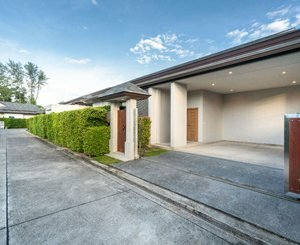 Optimization of driveways: practical and aesthetic solutions
-
 Zen Modular unveils the J-Room: the modular room that is revolutionizing the student residence market
-
 Are heat pumps ineffective in extreme cold?
-
 Alsic, specialist in thermal insulation products, offers solutions in accordance with decree no. 2023-444
-
 Summer comfort: the low-temperature heating-cooling floor/ceiling continues to stand out in new construction and renovation
-
 Respect for the environment, RE 2020: steel joinery has arguments!
-
 Louineau "total removal" solution for the renovation of joinery
Popular News
-
 Old property prices are still falling but a recovery is taking shape
-
 A report on anticipating the effects of +4°C warming reaffirms the need for housing adaptation
-
 AI is already revolutionizing businesses in architecture, engineering, construction... according to Autodesk's "State of Design & Make" study
-
 The slowdown in the decline in mortgage rates continues